
Frequently Asked Questions
What is the Riverfly Partnership?
The Riverfly Partnership is a network of organisations, representing anglers, conservationists, entomologists, scientists, water course managers and relevant authorities. We work together to protect the water quality of the UK’s rivers, further the understanding of riverfly populations, and actively conserve riverfly habitats. The main way we do this is through our citizen science scheme called the ‘Riverfly Monitoring Initiative’ (RMI), including the two extensions of it: ‘Urban Riverfly’ and ‘Extended Riverfly’. In these citizen science projects, volunteers monitor invertebrate life in their local rivers.
What are riverflies and why are they important?
Riverflies are invertebrates that spend most of their life cycle in a river, stream, pond or lake. Three key groups of riverflies are mayflies, caddisflies and stoneflies. You can find out more about them here.
In a healthy river, you would expect to find riverfly larvae all year round. They are very sensitive to changes in water quality, so if their numbers are low, it can indicate that there is a problem. They are seen as the ‘canaries of our rivers’. Being low down on the food chain, a drop in their numbers will go on to have a knock-on effect on the entire ecosystem. Monitoring riverfly populations can allow us to quickly identify issues such as pollution events.
Who can take part in riverfly monitoring?
The Riverfly Monitoring Initiative (RMI) is a citizen science project — you don’t need any qualifications or experience to become a monitor. All of the skills required will be taught to you at a training day led by an accredited Riverfly Partnership tutor. Monitoring involves entering a river/stream to carry out a kick sample, so you do need to feel physically capable of that, and you will need some wellies or waders.
What would I have to do as a riverfly monitor?
Trained riverfly monitors are assigned a site (or sites) on a river, which they go to on a monthly basis to collect data. A monitor will enter the river, carry out a three-minute kick sample and a one-minute hand search, then look at the invertebrates collected in a tray. You will have learnt on your training day how to identify the key riverfly groups, so you will be able to sort through your sample and count up the numbers in each group. The sample is then returned to the water, and the results uploaded to the national database.
A score is calculated from the number of riverflies present. The monitoring site will have a ‘trigger level’ — if the score from the sample falls below the trigger level, then a second sample needs to be carried out. If this second sample also produces a trigger level breach, then you would contact your co-ordinator, who would pass the information on to your local ecology contact (at the Environment Agency/Natural Resources Wales/Scottish Environment Protection Agency/Northern Ireland Environment Agency).
How do I get involved with the Riverfly Partnership?
E-mail as us at info@riverflies.org and let us know whereabouts in the UK you would like to monitor. If you’re covered by a Riverfly Hub, we’ll put you in touch with its co-ordinator, who will be able to let you know about upcoming training opportunities. The majority of training days usually take place in the spring/summer months, but you can register your interest at any time of year.
There are no active riverfly monitoring groups in my area. Can I set up my own group?
Yes! We have information on how to set up a new riverfly monitoring group here.
Can I carry out riverfly surveys wherever I want?
Riverfly surveys are carried out at sites that have been agreed between the co-ordinator of the riverfly monitoring group and the ecology contact from the statutory agency. Your co-ordinator might like you to survey a particular site that needs a monitor, or you may be able to suggest a site you would like to monitor — discuss this with them.
Why do monitors carry out surveys every month?
Monthly surveying creates long-term data sets that are useful for learning what is ‘normal’ for each site. If there is a drastic drop in riverfly abundance, we can catch it quickly, and be confident that it’s not just down to the natural fluctuations in population size. Going to the same site with this level of frequency also means riverfly monitors become ‘guardians’ of their patch — they quickly spot changes to the environment of any kind, such as visible signs of pollution that can be reported directly to the statutory agency.
How do RMI scores and trigger levels work?
RMI monitors count the number of riverflies they find in eight key groups. From these numbers, an RMI score is generated for that sample. Each site has a trigger level, decided by the ecology contact from the statutory agency, which shows the minimum RMI score that samples at that site should have if the river is in acceptable ecological health. If the RMI score of a sample is lower than the trigger level for that site, the monitor would then take a second sample to confirm the trigger level breach. Once confirmed, the statutory agency is informed.
What are the Urban and Extended Riverfly schemes?
Whereas the Riverfly Monitoring Initiative (RMI) involves counting eight groups of aquatic invertebrates, the Urban and Extended schemes cover a wider range. In the Urban scheme, six additional groups are added to the eight RMI groups, including more pollution-tolerant groups that have a negative effect on the score. You can go straight into Urban Riverfly monitoring — you don’t need to have done RMI first.
Once a monitor is experienced at RMI or Urban surveys, they can progress to be trained in Extended Riverfly. This scheme covers a total of 33 invertebrate groups, which have varying levels of tolerance to stressors. Extended surveys produce a ‘Water Quality Score’ and a ‘Silt and Flow Score’ — indices showing more detailed information on a river’s health.
How is the Riverfly Partnership’s data stored?
Our database is hosted by Cartographer. You can log in or sign up for an account here.
Can anyone view the data?
Yes — our data is open access. At present, you need to have a Cartographer account to view it on Cartographer, but anyone can sign up for one here, and that page also features an embedded map that anyone can view freely. Our developers are working on an online data viewing platform that will mean the data is more readily accessible to anyone, even if they don’t have an account. This will also include interactive graphs for easier viewing — in the meantime, you can use Cartographer’s ‘download’ function if you want to create your own graphs.
How is the Riverfly Partnership funded?
The Riverfly Partnership receives funding via income from fishing licence sales and a Water Environment Improvement Fund grant through the collaborative agreement with the Environment Agency. In addition, a grant from the Esmée Fairbairn Foundation was secured in January 2023, to develop the Riverfly Partnership nationally over three years.
How can I keep up-to-date with Riverfly news and events?
We send out a newsletter every two months. You can sign up for it here. We also frequently post on Facebook, X and Instagram. Check out our news blog on our website too.
Help for current monitors
What should I do if I can see visible signs of pollution at my monitoring site?
Visible signs of pollution (e.g. dead fish, extreme change in water colour or smell) should immediately be reported to the statutory agency 24-hour incident hotline – 0800 807060 in England, Scotland and Northern Ireland, or 0300 065 3000 in Wales. Give them your location and details of the suspected pollution event. Request and record an incident number for you to pass on to your co-ordinator. If there are obvious signs of pollution, it may not be necessary or safe to conduct a sample — you are not expected to put yourself at risk by entering the water for a kick sample.
What should I do if I can see invasive non-native species at my monitoring site?
If you recognise an invasive non-native species while sampling, you should report it to your co-ordinator. Take photos so that the sighting can be verified. The Great Britain Non-Native Species Secretariat is a useful resource for learning about and helping with the identification of invasive non-native species. Sightings can be reported to the INNS Mapper.
If you find crayfish, what you should do depends on which country you are in. Please follow this guidance if you are in England or Wales, click here for guidance in Scotland, and here for guidance in Northern Ireland.
Where can I get an underlay mat to place beneath my tray for sorting?
You can buy a waterproof ready-made underlay mat produced by Riverfly trainer and volunteer Dr Richard Osmond on his website here, or you can download, print and laminate one yourself here.
Can I change from RMI to Urban or Extended Riverfly monitoring?
Speak to your co-ordinator to express your interest. We can put your co-ordinator in touch with the nearest tutor.
Database help
How do I get access to the database?
Head to riverflies.org/cartographer — if you don’t have an account yet, use the form to sign up for one. We will then send you an invitation e-mail, where you can use the link to set up your password.
How do I submit my records?
When you have logged in to Cartographer, there’s a link to the help guide on the right-hand side of the home page. This will walk you through how to upload surveys, as well as how to confirm a trigger level breach and how to make changes to your account.
Is there an app for Riverfly surveys?
Although Cartographer is available as an app, this app does not yet support Riverfly surveys. This should be coming in a future update of the app — we will let monitors know when this is available.
How can I download data from the database?
From a list of surveys, you can use Cartographer’s ‘Download’ button to download the data you have filtered to as an Excel (XLSX) or Comma Separated Values (CSV) file (click here for Cartographer’s help page on this). From the map view, you can download the data for the currently visible region of the map using the buttons at the bottom of the ‘inspector’ panel on the left — this can be downloaded as a GeoJSON, KML or CSV file (click here for Cartographer’s help page on this).
Help for group co-ordinators and tutors
Can I add sites/add members to my group on Cartographer?
Yes. There’s a video here that shows co-ordinators how to add a new site to the database.
To invite new volunteers to your team on Cartographer, go to your ‘Team’ page, then click the ‘Invitations’ tab. Click the blue ‘Invite’ button, and enter the volunteer’s name and e-mail address, and put their ‘Team Role’ as ‘Team Surveyor’. When you click ‘OK’, they will receive an automated welcome e-mail from Cartographer, which will allow them to set up their password.
How do I order training packs for an upcoming Riverfly training day?
Please order training packs via email to KHadwin@fba.org.uk at least three weeks in advance. Packs come in two formats: the e-version is £10 each + p&p and includes files to print and collate. Or we can send full packs, costing £20 each + p&p, where we will print and collate everything for you.
Where do I order Riverfly monitoring kits from?
Approved kits are available to buy from NHBS here.
Can I upskill to become a trainer in Extended Riverfly?
We would like to hold a ‘train the trainer’ course at some point in 2024, where RP-accredited tutors could learn about the Extended programme and gain the skills needed to deliver this to volunteers. To express your interest, e-mail us at info@riverflies.org and let us know whether a course in London or at the FBA site on the shore of Windermere would suit you better.
Do I need to organise insurance?
Tutors and volunteers are covered by the Riverfly Partnership’s insurance for the duration of a training course. At any other point, monitors must be covered by their own hub/group insurance for carrying out volunteering tasks. Bigger hubs/groups often have their own insurance as part and parcel of their volunteer engagement offering. Smaller groups, angling groups and independents should seek to have their own insurance — if you search online for volunteer insurance, you will see find the options available.
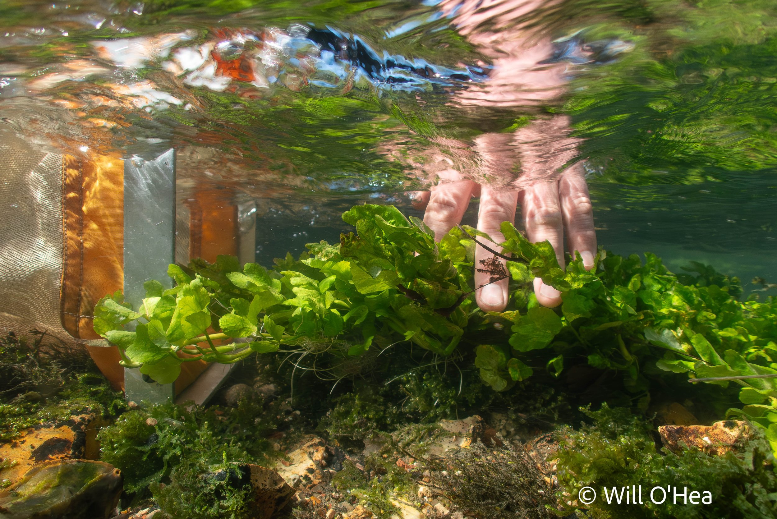
Header photo: copyright Will O’Hea